Welcome to Len Kubiak's Texas History Series


Longbranch Texas
History of the Longbranch Settlement in Falls County Texas and the people that once lived there.
Map of the Longbranch Settlement in Early Day Texas
ANCIENT HISTORY OF THE LONGBRANCH TEXAS REGION
For thousands of years, the region that became known as Longbranch was inhabited by roaming bands of Native Americans.
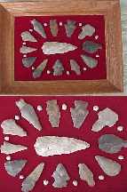
Many Indian relics were found along the plowed banks of nearby Fish Creek and a relic-laden midden once existed on the high side of the creek with a mound of clam shells over three feet thick.
SPANISH CLAIM TEXAS IN 1519
Slightly more than three centuries elapsed between the time the Texas shoreline was first viewed by a Spaniard in 1519 and July 21, 1821, when the flag of Castile and Le�n was lowered for the last time at San Antonio. During this period, the Spanish established missions to christianize the Indians. In 1821, the Mexicans defeated the Spanish and Texas once more became a territory of Mexico.
MEXICO ALLOWS SETTLEMENT IN TEXAS
After winning their independence from Spain, Mexico began to encourage Anglo Americans to settle into Texas. The area that became Reagan was part of Robertson's Colony settled in 1834 and 1835.

Sterling Clack Robertson was born on October 2, 1785, in Nashville, Tennessee. His father was Elijah Robertson, a brother of General James Robertson, the "Father of Middle Tennessee," and his mother was Sarah (Maclin) Robertson, for whom he later named the capital of his colony in Texas.
Major Sterling C. Robertson was one of seventy members of the Texas Association who on March 2, 1822, signed a memorial asking the Mexican Government for permission to settle in Texas. They finally received a contract in 1825, known as Leftwich's Grant, and Robertson came to Texas with the party sent to explore the territory, leaving Nashville on November 21, 1825, and remaining in Texas at least until August 24, 1826, on which date he made a deposition in San Felipe de Austin concerning the wife of Ellis Bean..
On October 15, 1827, this colonization project became known as the Nashville Colony, but nothing was actually done toward bringing settlers to Texas until April 26, 1830, when Robertson began to sign up families. The area assigned for settlements by the Nashville Company was transferred to Austin & Williams on February 25, 1831, and remained under their control until May 22, 1834.
ROBERTSON'S COLONY (1834-1835)
The decree of May 22, 1834, awarding the colony to Robertson confirmed the boundaries as they had been defined in the Nashville Company's contract of October 15, 1827. Beginning at the point where the road from B�xar (San Antonio) to Nacogdoches, known as "the Upper Road," crossed the Navasota River, a line was to be run along that road on a westerly course, to the heights which divided the waters of the Brazos and Colorado Rivers; thence on a northwest course along that watershed to the northernmost headwaters of the San Andr�s River (Little River), and from the said headwaters, northeast on a straight line, to the belt of oaks extending on the east side of the Brazos, north from the Hueco (Waco) Village, known as the "Monte Grande" ("Great Forest"), and in English as "the Cross Timbers," and from the point where that line intersected the Cross Timbers, on a southeast course along the heights between the Brazos and Trinity rivers, to the headwaters of the Navasota, and thence down the Navasota, on its righthand or west bank, to the point of beginning. That included all or part of the 17 counties listed above, under Leftwich's Grant, plus the 13 additional counties shown under the Nashville Colony, constituting an area 100 miles wide, beginning at the San Antonio- Nacogdoches Road and extending northwest up the Brazos for 200 miles, centering around Waco.
In that 1834 session of the legislature, Robertson was recognized as the empresario of the colony, and he was to introduce the rest of the 800 families into the colony before April 29, 1838. Each family that dedicated itself solely to farming was to receive one LABOR (177.1 acres) of land; those who also engaged in ranching were to receive an additional SITIO (1 league, or 4,428.4 acres) . Single men were to receive 1/4 league (1,107.1 acres). For each 100 families introduced, Robertson was to receive 5 leagues and 5 labors (or a total of 23,027.5 acres) of premium lands. William H. Steele was appointed Land Commissioner of the Nashville (or Robertson) Colony on May 24, 1834, and he appointed John Goodloe Warren Pierson as Principal Surveyor, on September 17, 1834.
The capital of the colony was laid out at the Falls of the Brazos (about 8 miles northwest of the Longbranch area and named Sarahville de Viesca: "Sarah" for Empresario Robertson's mother, Sarah (Maclin) Robertson, who had loaned him the money for the project, and "Viesca" for Agust�n Viesca, the Mexican official who was presiding over the state legislature when it granted the contract to Robertson. All the Robertson Colony land grants were issued in Viesca, Texas.
The first land title was issued on October 20, 1834, but all the colonial land offices were closed, by the Provisional Government of Texas, on November 13, 1835, because of the outbreak of the Texas Revolution, thus preventing Robertson from completing the full quota of 800 families. However, according to a ruling handed down by the Supreme Court of the State of Texas, in December of 1847, Robertson was given credit for having introduced a total of 600 families.
Following the Texas Revolution, the Robertson Colony area was broken up to form all or part of the thirty present-day Texas counties which have been listed under Leftwich's Grant and the Nashville Colony.
FISH CREEK/GUFFEE/HOG ISLAND SETTLEMENTS
The region in Falls County located approximately five miles southeast of the falls on the Brazos and three mile southwest of Blue Ridge was originally home to several early-day settlements including: Fish Creek settlement, Hog Island settlement , the Guffee settlement, and the Longbranch settlement.
FISH CREEK SETTLEMENT
The Fish Creek Settlement on the eastern banks of Fish Creek some 3 miles west of Longbranch was established in the 1830's during the days of the Texas Republic.
In this area, a few hardy settlers built log cabins, tilled the land and traded with the Indians at a trading post near the settlement of Fish Creek. One of the early-day Reagan region settlers was James Barton who was appointed tax collector of the Fish Creek Community by the Republic of Texas government in the late 1830's.
In the period from 1840 to 1870, several families settled the Fish Creek and Blue Ridge area including Joe Tucker who later operated a stage stop in Blue Ridge, the Curreys, Clarks, Wards, Johnsons, Kinnards, Beals, Cowans, Owens, Robertsons, Wyches, Combs, and Hagens families.


Isaac Newton, Jr. and Rachel Louise Covington Crouch, pioneer settlers from Tennessee that settled in the fish creek area near Longbranch Texas in the 1840's. Isaac was born Nov 1825 in Washington Co., TN and died Apr 15, 1900 in Reagan. Rachael was born on Jan 16, 1826 in Rutherford Co., TN and died in Reagan on January 26, 1887.
William W. Crouch was born in 1849 in the area that became Reagan Texas.
The Fish Creek settlement developed along what is now the "Reagan to Kosse" road, near the old Danford Dairy area and a few miles west of the Longbranch settlement. Initially, the settlement contained an old general store and a gristmill but later expanded to include a stage stop/inn and a blacksmith shop by the Civil War era.

Blacksmith Shop in Nearby Fish Creek Settlement

Stagecoach, wagon, or horseback was the only way to get to the Longbranch community from the early-day Fish Creek settlement
LONG BRANCH, FALLS COUNTY, TEXAS
The settlement of Long Branch (named for the nearby Longbranch creek)was established in the early 1830's near the intersection of present-day county roads 263 and 2413.
The Longbranch settlers came to Texas in 1830, when Robertson began to sign up families.
A primitive trading post at Long Branch provided supplies for the local trappers that worked the area streams and creeks including Polecat Creek, Buckhorn Creek, Duck Creek, Rocky Creek, Willow Creek, Salt Creek, and Sulphur Creek. These trappers traded tanned furs for supplies and whiskey.
Stagecoach and horseback were the only means of transportation for this primitive Texas settlement located near the Fish Creek settlement and the Blue Ridge Settlement.
 For questions or comments, send me an Email
|
Don't forget to bookmark our site and come back often!! Thanks for visiting!! *******CONTACT INFORMATION******* EMAIL ADDRESS: lenkubiak.geo@yahoo.com PHONE: 512 630 4619 Click on the deer to add This Page To Your list of webpage Favorites.  COME BACK TO SEE US OFTEN!
|


