CEDAR SPRINGS WEBSITE


History of Cedar Springs, Rosebud, Chilton, Mooresville, and Wilderville Settlements of Falls County, Texas
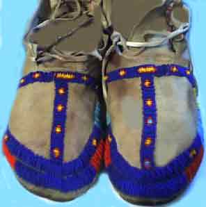
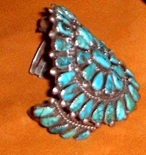
For untold centuries, the central Texas region around the falls on the Brazos was rich in wildlife, fish, fertile river bottoms and home to many ancient Indian tribes including the Huacos, the Tonkawas, the Caddoes, the Apaches, the Cherokees, the Yeguas, and later the Comanches and Kiowas.
SPANISH CLAIM TEXAS IN 1519
Slightly more than three centuries elapsed between the time the Texas shoreline was first viewed by a Spaniard in 1519 and July 21, 1821, when the flag of Castile and Le�n was lowered for the last time at San Antonio. During this period, the Spanish established missions to christianize the Indians. In 1821, the Mexicans defeated the Spanish and Texas once more became a territory of Mexico.
MEXICAN TEXAS SETTLEMENTS
After winning their independence from Spain, Mexico began to encourage Anglo Americans to settle into Texas. The area that became Pond Creek (Rosebud), Wilderville, and Cedar Springs was part of Robertson's Colony settled in 1834 and 1835.

Sterling Clack Robertson was born on October 2, 1785, in Nashville, Tennessee. His father was Elijah Robertson, a brother of General James Robertson, the "Father of Middle Tennessee," and his mother was Sarah (Maclin) Robertson, for whom he later named the capital of his colony in Texas.
THE ROBERTSON COLONY NEAR PRESENT DAY WILDERVILLE
Major Sterling C. Robertson was one of seventy members of the Texas Association who on March 2, 1822, signed a memorial asking the Mexican Government for permission to settle in Texas. They finally received a contract in 1825, known as Leftwich's Grant, and Robertson came to Texas with the party sent to explore the territory, leaving Nashville on November 21, 1825, and remaining in Texas at least until August 24, 1826, on which date he made a deposition in San Felipe de Austin concerning the wife of Ellis Bean.
On October 15, 1827, this colonization project became known as the Nashville Colony, but nothing was actually done toward bringing settlers to Texas until April 26, 1830, when Robertson began to sign up families. The area assigned for settlements by the Nashville Company was transferred to Austin & Williams on February 25, 1831, and remained under their control until May 22, 1834.
The decree of May 22, 1834, awarding the colony to Robertson confirmed the boundaries as they had been defined in the Nashville Company's contract of October 15, 1827. Beginning at the point where the road from B�xar (San Antonio) to Nacogdoches, known as "the Upper Road," crossed the Navasota River, a line was to be run along that road on a westerly course, to the heights which divided the waters of the Brazos and Colorado Rivers; thence on a northwest course along that watershed to the northernmost headwaters of the San Andr�s River (Little River), and from the said headwaters, northeast on a straight line, to the belt of oaks extending on the east side of the Brazos, north from the Hueco (Waco) Village, known as the "Monte Grande" ("Great Forest"), and in English as "the Cross Timbers," and from the point where that line intersected the Cross Timbers, on a southeast course along the heights between the Brazos and Trinity rivers, to the headwaters of the Navasota, and thence down the Navasota, on its righthand or west bank, to the point of beginning. That included all or part of the 17 counties listed above, under Leftwich's Grant, plus the 13 additional counties shown under the Nashville Colony, constituting an area 100 miles wide, beginning at the San Antonio- Nacogdoches Road and extending northwest up the Brazos for 200 miles, centering around Waco.
In that 1834 session of the legislature, Robertson was recognized as the empresario of the colony, and he was to introduce the rest of the 800 families into the colony before April 29, 1838. Each family that dedicated itself solely to farming was to receive one LABOR (177.1 acres) of land; those who also engaged in ranching were to receive an additional SITIO (1 league, or 4,428.4 acres) . Single men were to receive 1/4 league (1,107.1 acres). For each 100 families introduced, Robertson was to receive 5 leagues and 5 labors (or a total of 23,027.5 acres) of premium lands. William H. Steele was appointed Land Commissioner of the Nashville (or Robertson) Colony on May 24, 1834, and he appointed John Goodloe Warren Pierson as Principal Surveyor, on September 17, 1834.
The capital of the colony was laid out at the Falls of the Brazos (about 6 miles northwest of the Reagan area and named Sarahville de Viesca: "Sarah" for Empresario Robertson's mother, Sarah (Maclin) Robertson, who had loaned him the money for the project, and "Viesca" for Agust�n Viesca, the Mexican official who was presiding over the state legislature when it granted the contract to Robertson. All the Robertson Colony land grants were issued in Viesca, Texas.
The first land title was issued on October 20, 1834, but all the colonial land offices were closed, by the Provisional Government of Texas, on November 13, 1835, because of the outbreak of the Texas Revolution, thus preventing Robertson from completing the full quota of 800 families. However, according to a ruling handed down by the Supreme Court of the State of Texas, in December of 1847, Robertson was given credit for having introduced a total of 600 families.
Following the Texas Revolution, the Robertson Colony area was broken up to form all or part of the thirty present-day Texas counties which have been listed under Leftwich's Grant and the Nashville Colony.
The region in Falls County located below the falls on the Brazos along the west bank was home to several early-day Texas settlements in the 1800's including Cedar Springs, Wilderville, and Pool's Crossing (later became Rosebud).
Pool's Crossing/Rosebud
Rosebud grew out of a settlement along the west bank of Pond Creed in 1878 and early-on called
Pool's Crossing or Greer's Horse Pen. In 1884, Rosebud moved east a few miles to its present location.
Rosebud Post Office (1887)
In 1884 Albert G. Tarver established a post office in the Rosebud area called Mormon, after a group of Mormons who had settled in the area. However, the settlement was destroyed by fire in 1887, and Tarver resigned as postmaster.
Allin Taylor took up postmaster duties in his home, at a site now in southwestern Rosebud. Taylor wanted to name the post office Mullins to honor a local family known for their beautiful roses, but a Mullins community already existed in Texas, so he named it Rosebud instead; the post office officially became Rosebud on April 23, 1887.
Rosebud was developed by the Texas Townsite Company in 1889 . Then in 1892, the San Antonio and Aransas Pass Railway completed their railroad line through Rosebud on its route from Waco to Giddings, and thereafter the town grew rapidly. The rich blackland soil of the area produced abundant cotton and grain, and by the 1920s the town had seven cotton gins and a cottonseed mill.
Rosebud declined, however, during the Great Depression,and local farmers turned to ranching and raising wheat and small grain. The railroad was discontinued in 1968, and the tracks and the station were removed. In the late 1980s Rosebud had approximately 2000 residents, a hospital, a nursing home, a consolidated high school, thirteen churches-and a rosebush in every yard, a tradition initiated by an editor of the town paper. Many residents commuted to work in other cities. The population in 1990 was 1,638.
Wilderville, Texas
To the south of Cedar Springs is the village of Wilderville,
established as a town in the early 1870s (named for the E. M. Wilder family, who became landowners in the area shortly after the Civil War).
The Wilderville post office opened in 1874 (and later closed in 1906). In the 1880's, Wilderville was a thriving community with two churches, a school, steam gristmills and cotton gins, a weekly newspaper, and over 300 residents.
The rich bottomland along the brazos river was ideal for growing cotton and grain. The community faded around 1900 and by 1906, the post office was closed.
A school, a church, and a few scattered houses marked the community on county highway maps in the late 1940s, and the population on the last census was reported at forty-five.
Cedar Springs/Viesca
Cedar Springs, once known as Mill Tract, is on Farm Road 2027 nine miles south of Marlin in south central Falls County a few miles southeast of the present-day town of Rosebud.
Cedar Springs was named for several springs that flowed through a nearby cedar grove. In the early 1870s, the community had a sawmill, a gin, and a store.
In 1879 a post office was established in Cedar Springs, taking the name Viesca, after the colonial settlement Sarahville de Viesca, which had been five miles north in the 1830's. The community of Cedar Springs had a population of thirty settlers in the mid-1880s. By 1890, Viesca had over a hundred residents, a general store, and a hotel.
When the San Antonio and Aransas Pass Railway completed the section of track between Waco and Lexington in 1891, it bypassed Viesca by six miles. Many of the local residents were drawn to the railroad and the newly established community of Lott; others moved to Rosebud. As a result, the population of Viesca fell to less than 25 when the post office was discontinued in 1905. At this point, the community resumed the name Cedar Springs.
In 1905, Cedar Springs had a two-teacher school with sixty-six white students and a one-teacher school with eighty-one black students. Until the mid-1950s, Cedar Springs served as the focus of a common-school district; this district was divided and consolidated with the Lott and the Rosebud school districts in 1955.
Cotton and corn were the principal crops grown by farmers in the Cedar Springs area until the 1930s when tomatoes were introduced as a specialty crop. Farmers also began to grow watermelons, cantaloupes, and sweet potatoes.
In the 1950's and 60's, livestock (chicken, turkeys, mules and cattle) became a larger part of the local economy as cotton production slowed down somewhat.
The population of Cedar Springs fell to fifteen in the early 1930s but increased to around seventy by 1945. A school, a church, and several residences marked the community in the late 1940s. Currently, the area population is around 100.

BIBLIOGRAPHY: Roy Eddins, ed., and Old Settlers and Veterans Association of Falls County, comp., History of Falls County, Texas (Marlin, Texas, 1947). Lillian S. St. Romain, Western Falls County, Texas (Austin: Texas State Historical Association, 1951). Vertical File, Texas Collection, Baylor University.
HISTORY OF MOORESVILLE, FALLS COUNTY, TEXAS
Mooresville, located approximately
four miles northwest of Chilton in northwestern Falls County, was named for Robert Moore, who opened the first store in the area in the 1850s.
In the 1860s Ed McCullough donated land for a church, a school, and a cemetery.
A post office called Mooresville was established in 1878; the name was changed to Mooreville in 1892. The population of the town grew from twenty-five in the mid-1880s to 180 by the early 1890s. Some of the local businesses in Mooresville in 1890 included a general store, a gristmill and again, and a grocery.
The San Antonio and Aransas Pass Railway built a section of track from Waco to Lott in 1889, passing four miles east of Mooreville, giving area residents easier access to markets. In 1900 Mooreville had 182 residents.
In 1906, the Mooreville post office was discontinued and the community got its mail through Bruceville and, later, through Chilton.
The Mooreville school district had ninety-seven students in 1933. In 1950, the community population dropped below a hundred and the school district was consolidated with the Chilton Independent School District and the school building was converted to a community center.
The population of Mooreville remains below a hundred today.
HISTORY OF CHILTON, FALLS COUNTY, TEXAS
The first white settlers in the Chilton area (that was originally called was originally called Abney's Farm) were five Missouri families who arrived in 1854 by oxen-pulled covered wagons and by horseback.
These initial five families were all from Missouri andincluded the Dixons, Grahams, McCutchans, Maxeys and Weathers. They crossed the Brazos river at the Falls of the Brazos, and located in the settlement now known as Chilton.
"Father built a log house south of where the depot now stands. He was the first white settler in the present town of Chilton. The nearby settlements were Durango to the southwest, and old Carolina to the south, and Mooreville five miles northwest. The county was wild and unsettled, we all lived in log cabins. The roads were just cow trails and when we needed any supplies we sent our produce-- corn, hogs and later on cotton, to Millikens, where they were exchanged for farming implements, clothes and groceries. They drove through in the ox-drawn wagons and would be gone from five to six weeks.
Newton B. Maxey, one of the early settlers, established a wagon line to Galveston to bring in supplies.
It was just a few weeks after they reached Texas that Mr. Weathers was killed accidentally by the hired man who mistook him for a bear. They were out hunting and had killed a deer, grandfather Weathers had on a coat made of bear skin and was leaning over the deer, skinning it, when the hired man saw him and thinking it was a bear eating the deer, he fired the fatal shot which cost Weathers his life. He was the first person buried in old Carolina cemetery. Carolina was once a settlement between the present town of Durango and Chilton, some few miles west of the town of Marlin and in what we called West Falls County. Today all that remains is the old cemetery .
In 1873, the site that later became Chilton was bought by James C. Gaither who was to become one of the most prominent citizens of Chilton. Gaither was
born in Iredell County, North Carolina, the son of Forest and Lamira Caldwell Gaither and came to Texas as a first lieutenant of Captain Evans' regiment in the war with Mexico (1846).
The early settlers attended the
Cow Bayou Baptist Church, the minutes dating from its organization are in possession of Mrs. Susie Miles, of Chilton. This old church was rebuilt once, the members worshipped there on the banks of the bayou for many years, and at times at old Cottonwood school house, finally building a church on the hill at Mooreville (five miles away), overlooking Cow Bayou, not far from where the early Mooreville school house stood. Later lightning struck the church after it had been moved to the hill and it burned to the ground. The congregation met for a number of years at the school house.
Some time after the World War, this church dissolved, members having moved away. The Methodist Church established on its present site in 1874 served the community since.
In 1876 Lysias B. Chilton, in partnership with W. J. de Bardeleben, opened a store near the present site of Chilton.
CHILTON POST OFFICE (1882)
The Chilton post office opened in 1882 and was named after Lysias B. Chilton who had opened the first store in the region. By 1884, the Chilton settlement had a population of 100, a steam flour mill, a cotton gin, a Baptist church, a First Christian church, and a district school. On December 17, 1886, Chilton Lodge No. 639, AF&AM, was chartered.
In 1887, James C. Gaither sold land to the San Antonio and Aransas Pass Railway for the new townsite that was built along the tracks in 1888, and officially designated Chilton by the Texas Townsite Company. Chilton then became one of several railroad stations in Falls County and served as a shipping center.
By 1896 the Chilton school had three teachers.
By 1914 Chilton had a bank, three churches, a large lumberyard, two cotton gins, a new schoolhouse, a telephone system, and a weekly newspaper, the Chilton Homeland.
The first oil well in the county was brought in on Deer Creek southeast of Chilton in April 1922. During an attempt to find oil in 1924, hot artesian wells were discovered, and the water was piped throughout the town. In 1935 the Chilton school district had 585 students, 8 percent of the students in Falls County. By the mid-1950s, when the Chilton district was one of only four independent school districts in the county, the town's population reached 750. It stayed at that level until the mid-1970s, when the number of residents dropped to 310, which was still the reported population in 1990. In the 1930s the town had twenty-five businesses, but by 1966 the number had dropped to eleven. In 1988 Chilton had ten businesses, six churches, one school, a town hall, and a recreation center.
BIBLIOGRAPHY: William Leshner, "Rosebud, Lott, and Chilton, Texas," Texas Magazine, January 1911. Lillian S. St. Romain, Western Falls County, Texas (Austin: Texas State Historical Association, 1951).
Eye Witness Account of the Settlement of Chilton
The following interview with Mrs. Amanda E. Lockered of Chilton, Texas many years ago gives us an eye-witness account of the history of the area.
"I was born in Falls County in 1856. My parents were Newton B. and Susan Weathers Maxey. Father was born May 6, 1832 in Kentucky, while mother was born in Indiana. To them were born seven children, namely: Billie Maxey, of Marlin, Texas, Deceased; Steve Maxey of Chilton, deceased; John D. Maxey, Lorena, Texas, deceased; Mrs. Dicey Hyden, Chilton, Texas, deceased; Mrs. Mattie Shields of Mart, Texas, and Albert Maxey of Waco, are still living, the only two besides myself left of this large family.
"During the Civil War father served under the Confederate flag, and was stationed at Calveston, Texas. He was home on a sick furlough when the war closed. He came to Texas about the year 1851 or '52. There were five families who came through driving oxen to their wagon train. They were all from Missouri, and were the Dixons, Grahams, McCutchans, Maxeys and Weathers. The daughter of Mr. Weathers, Susan, being my mother. They crossed the Brazos river at the Falls of the Brazos, and located in the settlement now known as Chilton.
"Father built a log house south of where the depot now stands. He was the first white settler in the present town of Chilton. The nearby settlements were Durango to the southwest, and old Carolina to the south, and Mooreville five miles northwest. The county was wild and unsettled, we all lived in log cabins. The roads were just cow trails and when we needed any supplies we sent our produce-- corn, hogs and later on cotton, to Millikens, where they were exchanged for farming implements, clothes and groceries. They drove through in the ox-drawn wagons and would be gone from five to six weeks.
"Another early settlement over towards Marlin was Cedar Springs, so called from a number of springs. One spring was located in the valley near the cross-roads to Marlin where [?] store stands today. Near the spring stood a large cedar tree and nearby a group of smaller cedar trees. Hence the name of "Cedar Springs". These springs are near the river and only a few miles south of the spot conceded to be the old site of Vienea. The mail carrier was "Croft Downs", so Mr. Green Roberts recalls. He was a bachelor and he always seemed to derive special pleasure from a plug of chewing tobacco and an occasional drink of whiskey, and carrying the mail in all kinds of weather. He rode horseback and carried the mail from Marlin through [Viones?] and on to the other communities. Later it was carried from Marlin to Eddy by a negro named John Love. This route went through Chilton and Mooreville.
"The mail carrier's had the Brazos to ford at the Falls, or when it was on a rise if they did not appear on schedule--we knew the old river was on a rise and they could not swim their horses over it. There was a story of Croft Downs trying to swim the river while it was on one of these rises. The water was swift and near the flood stage, when he started across eye-witnesses said they saw the mail carrier, mail and all, slip under the pressure of the current, plunge over the falls and disappear in the deep, whirling water below. A party hurried to the rescue, expecting to drag a corpse from its depths. But they were mistaken. The mail carrier, horse and mail, had drifted down past the bend, through treacherous Sumpter Hole, and had climbed out on the west side of the river. The mail went through--after having been delayed only an hour!
"The Brazos bottom at that time was densely timbered and all kinds of wild animals lived in it. There was wild game to satisfy the greatest of hunters. Deer, bear and wolves, as well as all kinds of birds abounded in the timber. While on the banks of the river occasionally an alligator could be seen as he slept in the sun by the bank. This reminds me of a story of my father. It may sound a little far-fetched, but nevertheless it is true. He often hunted fifteen or twenty miles from home on the river. On one of these trips he carried several hunting dogs. They came upon one of these alligators on the river bank and the dogs attacked it. The alligator turned and swallowed the dog. My father immediately stabbed the huge alligator with his large dirt hunting knife, rescued the dog alive, from its stomach. It was all over in just a few minutes, only the time it took to stab the animal through the heart and cut it open and rescue the dog. Another time he killed a bear with this knife.
"It was just a few weeks after they reached Texas that my grandfather [Weathers?] was killed accidentally by the hired man who mistook him for a bear. They were out hunting and had killed a deer, grandfather Weathers had on a coat made of bear skin and was leaning over the deer, skinning it, when the hired man saw him and thinking it was a bear eating the deer, he fired the fatal shot which cost my grandfather his life. He was the first person buried in old Carolina cemetery. Carolina was once a settlement between the present town of Durango and Chilton, some few miles west of the town of Marlin and in what we called West Falls County. Today all that remains is the old cemetery where our loved ones lie.
We went to the old Cow Bayou Baptist Church, the minutes dating from its organization are in possession of my daughter, Mrs. Susie Miles, of Chilton. This old church was rebuilt once, the members worshipped there on the banks of the bayou for many years, and at times at old Cottonwood school house, finally building a church on the hill at Mooreville (five miles away), overlooking Cow Bayou, not far from where the early Mooreville school house stood. Later lightning struck the church after it had been moved to the hill and it burned to the ground. The congregation met for a number of years at the school house.
Some time after the World War, this church dissolved, members having moved away. The Methodist Church established on its present site in 1874 served the community since. Its Sunday School being regularly attended by children and members of other denominations in the community.
 For questions or comments, send me an Email at lenkubiak.geo@yahoo.com For questions or comments, send me an Email at lenkubiak.geo@yahoo.com
MORE PLACES TO GO
Don't forget to bookmark our site and come back often!! Thanks for visiting!!
Click on the deer to add
This Page To Your list of webpage Favorites.

COME BACK TO SEE US OFTEN!
|
Copyright � 1996, 1997, 1998, 1999, 2000, 2001, 2002, 2003, 2004, 2005, 2006, 2007, & 2008. All rights
reserved by Leonard Kubiak. Fort Tumbleweed™ and forttumbleweed™ are trademarks of Leonard Kubiak. No Part of this Website nor any
of it's contents may be
reproduced in any manner without written permission.
|
Fort Tumbleweed Homepage
|